3.33 hectares
with an approved study
Benátky nad Jizerou · plots 470/39 and 470/40 · sale to an investor
Two adjoining plots directly at the D10 motorway exit. Documentation prepared for 204 residential units, community facilities and underground parking. Sale to a single investor, with the option of phasing.
- Total area
- 33,300 m²two plots, 3.33 ha
- Residential units
- 204per the approved study
- Coefficient
- 0.60site coverage under the zoning plan
- Prague, Černý Most
- 21 minvia the D10, exit next to the site
Drawing 01 Plots 470/39 and 470/40 · ČÚZK orthophoto, boundaries per the land registry
subject of sale boundary between the plots boundaries and areas per the land registry
01Subject of sale
Two plots,
one site
The plots are sold together, including the design documentation prepared to date.
- Plot
- 470/39 — 18,479 m²
- Plot
- 470/40 — 14,821 m²
- Cadastral area
- Staré Benátky 602124
- Title deed (LV)
- 3384
- Zoning plan
- Mixed-use urban residential areas SM, SM1
- Site coverage coefficient
- 0.60
- Current land type
- Arable land, BPEJ 22110
- Form of sale
- Through a broker
Pricing structure
A one-off purchase is priced more favourably than a phased purchase in stages over several years. Phasing is possible. The specific price is subject to negotiation, and the owner will consider proposals from interested parties.
Drawing 02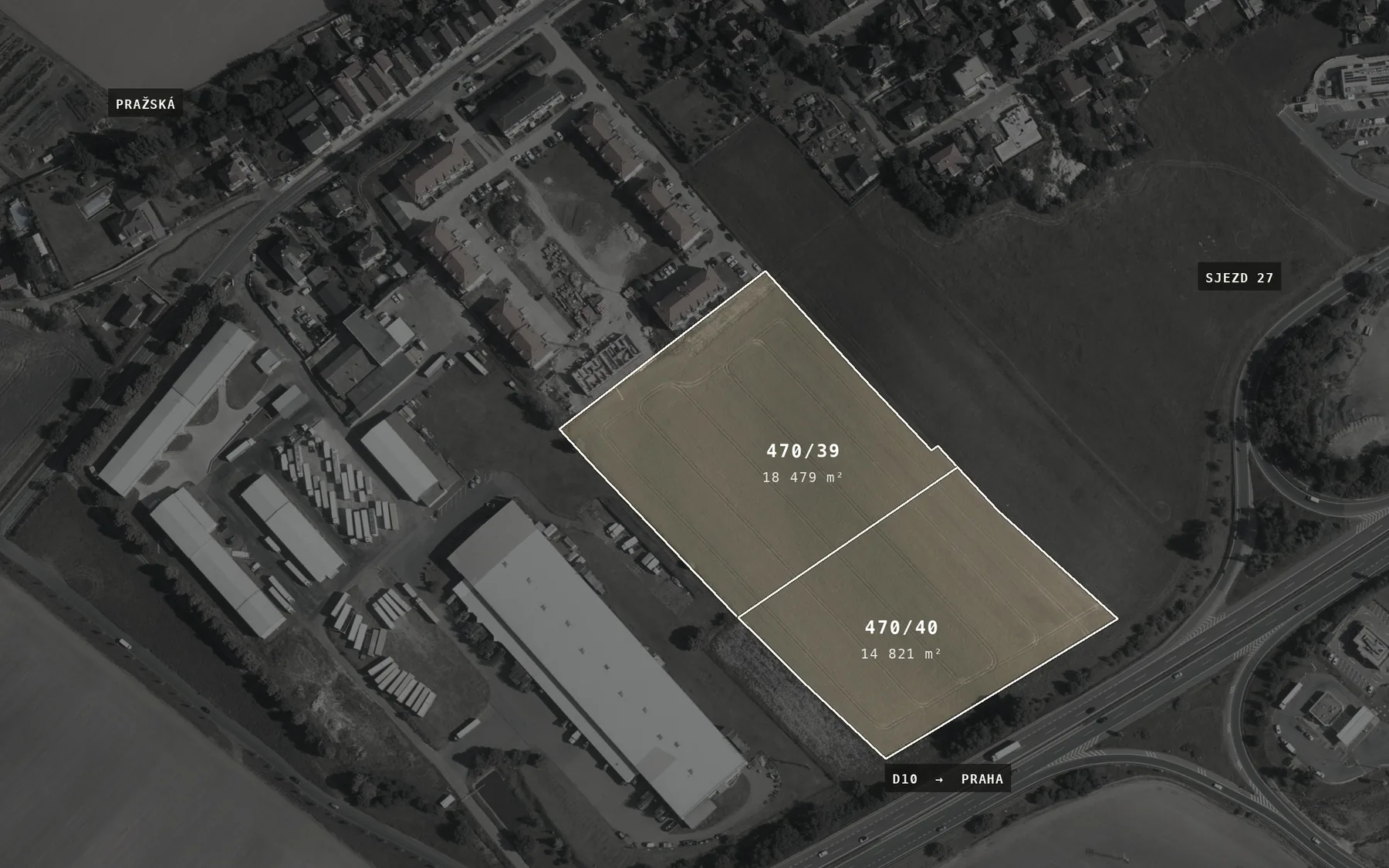
Drawing 02 Plots 470/39 and 470/40 and their immediate surroundings · ČÚZK orthophoto, boundaries per the land registry
02Proposed scheme
What is proposed on the site
Based on the zoning study approved by the town and entered in the register of spatial planning activities. The investor is not strictly bound by the exact form of the scheme: in a mixed-use urban residential area it has relatively wide latitude in what it builds.
Apartment buildings
6 buildings- Residential units180
- Apartment floor area12,306 m²
- Common areas2,023 m²
- Underground parking7,334 m²
Semi-detached villas
4 buildings- Residential units24
- Floor area2,496 m²
- Basement levelyes
Community facilities
mixed-use- Primary school and nursery school
- Office space
- Bistro and gym
- Underground parking2,236 m²
Drawing 03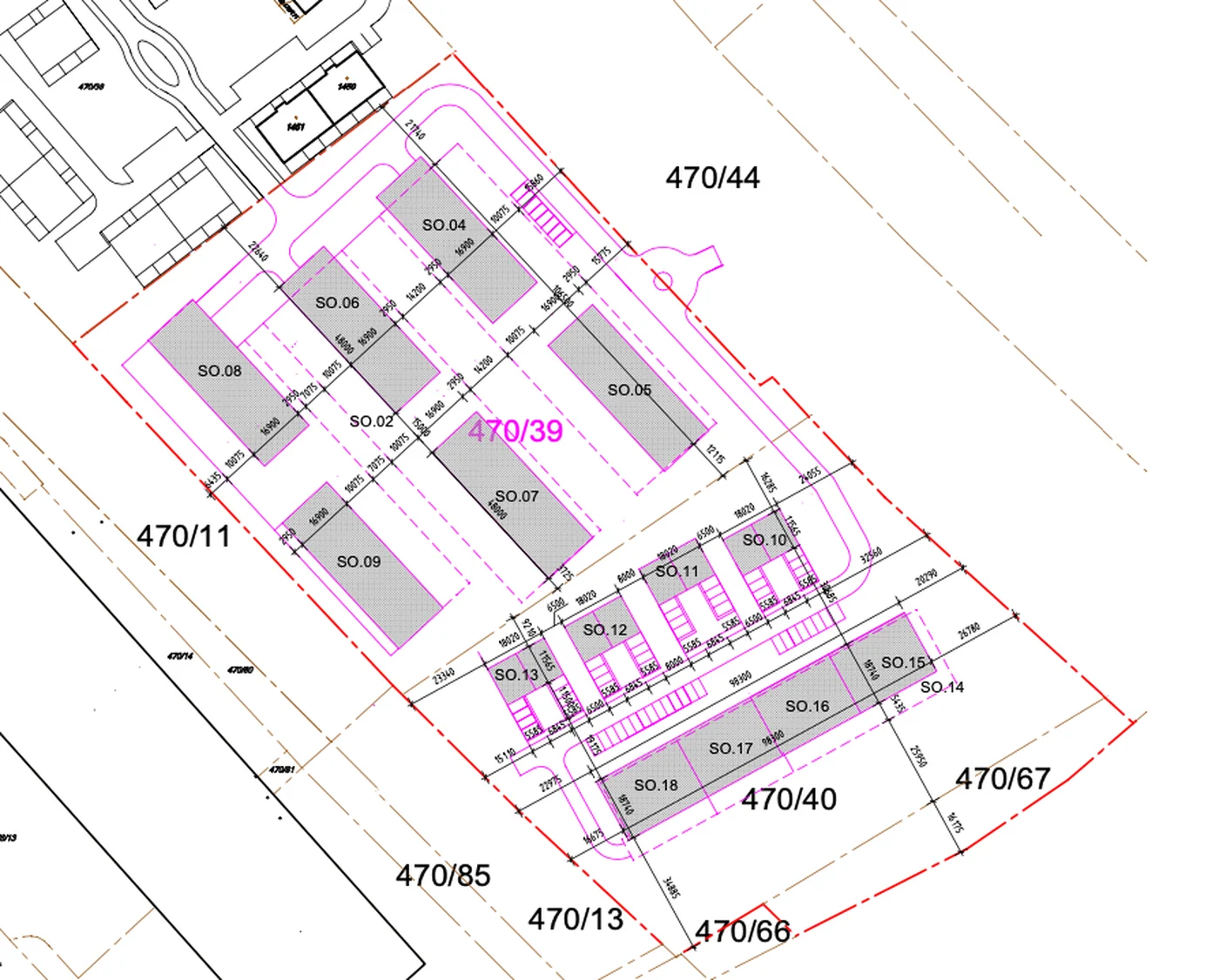
Drawing 04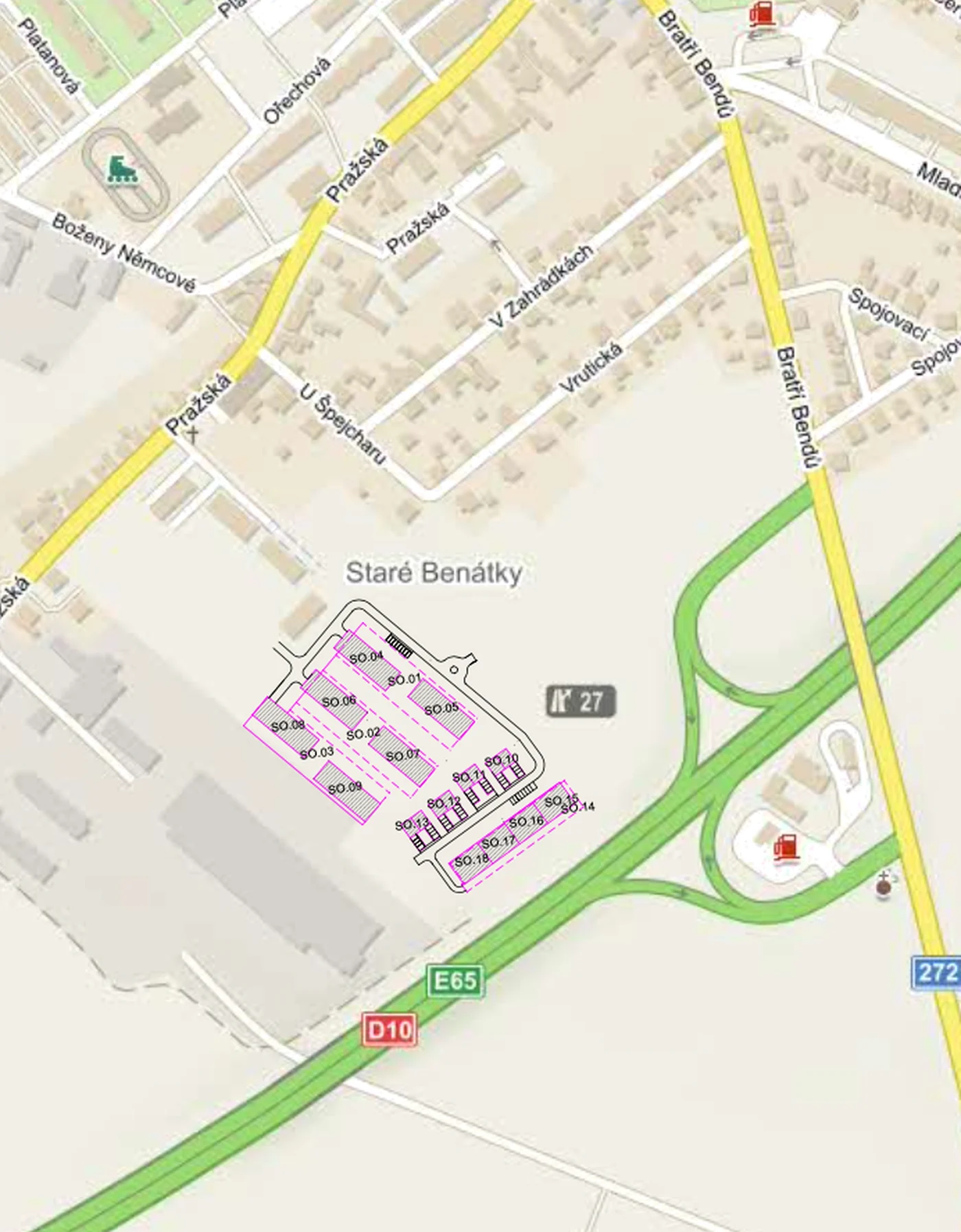
03Visualisations
How the scheme looks
The visualisations are based on materials prepared during the project's development and are intended as an illustrative preview. The project has evolved over time, and the purchasing investor is not bound by their exact form.
V 01
V 02
V 03
V 04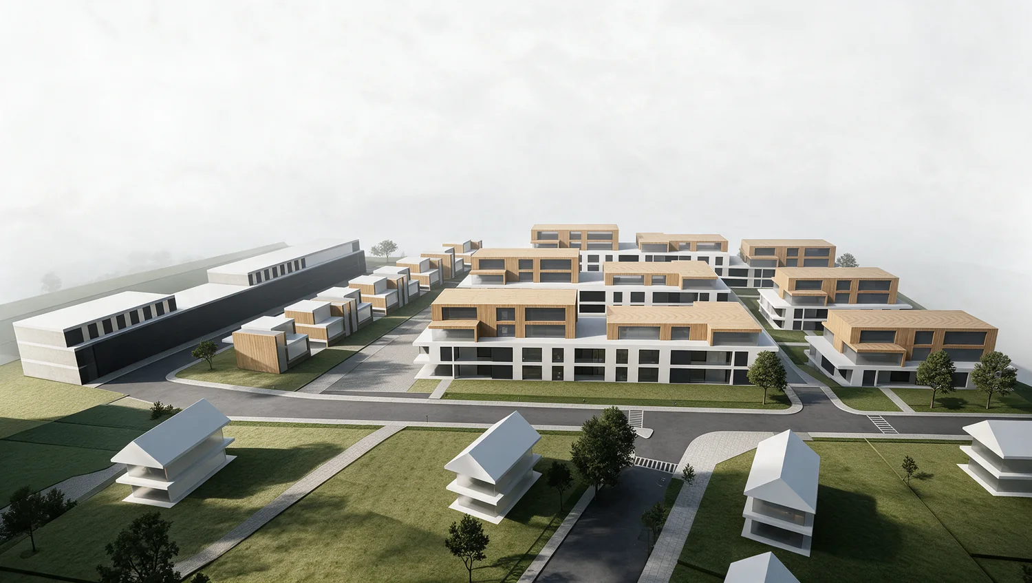
V 05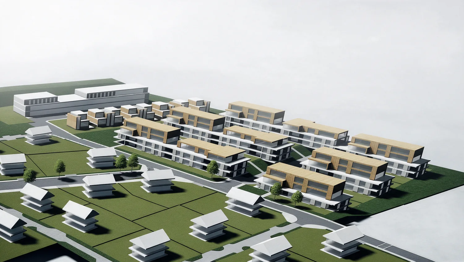
V 06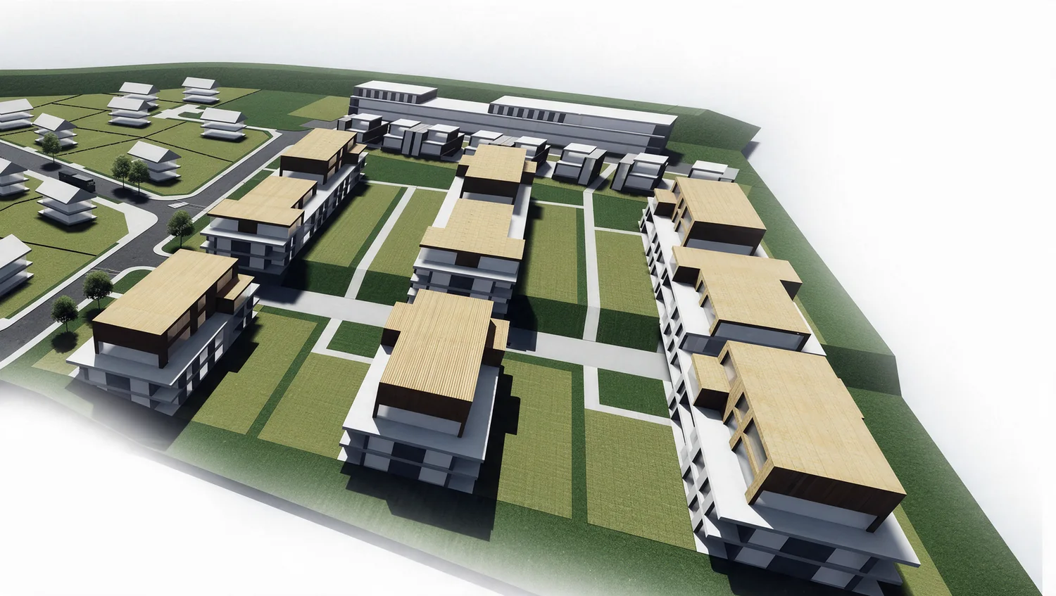
V 07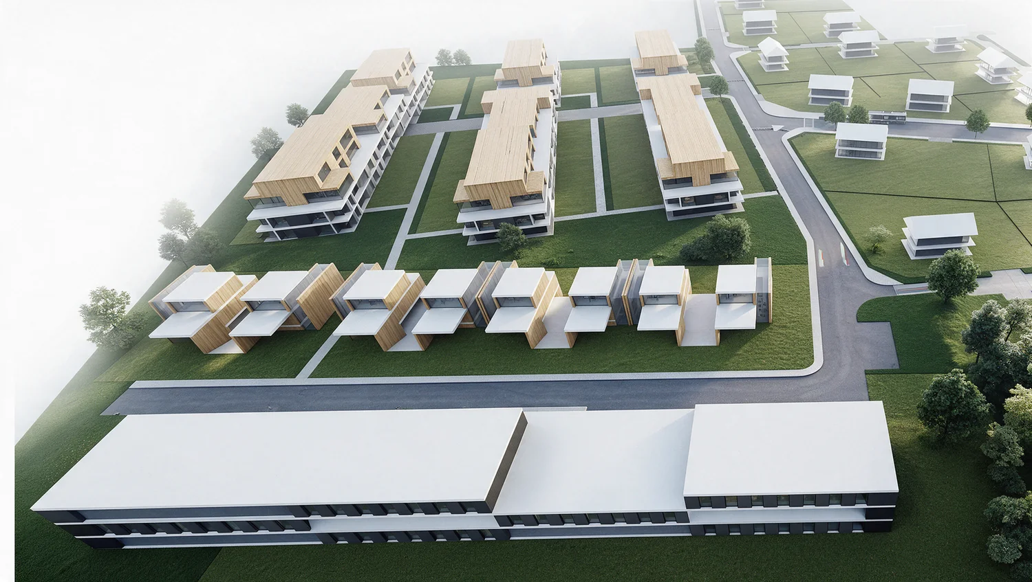
V 08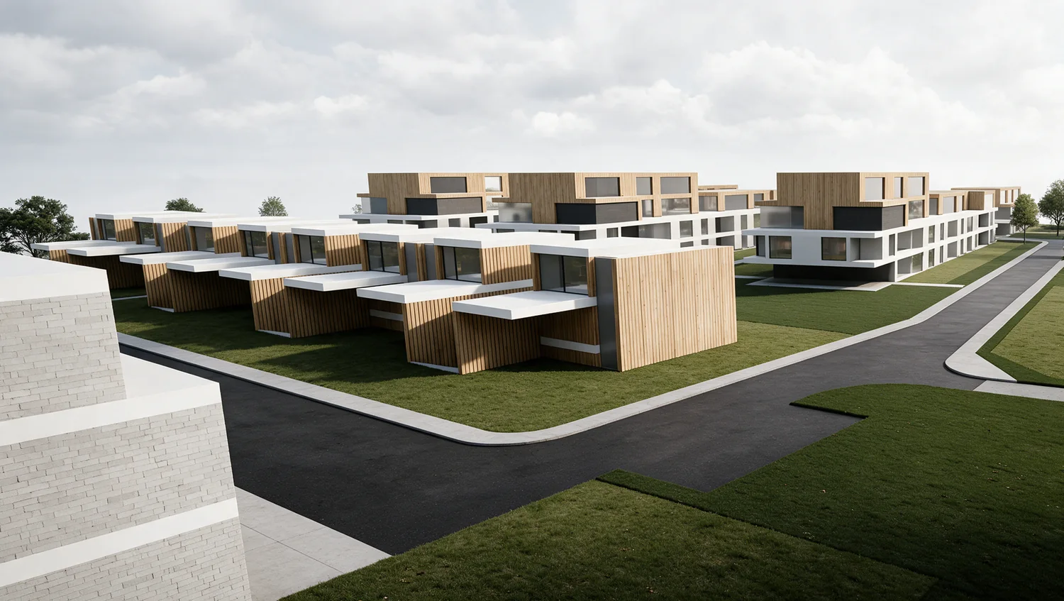
V 09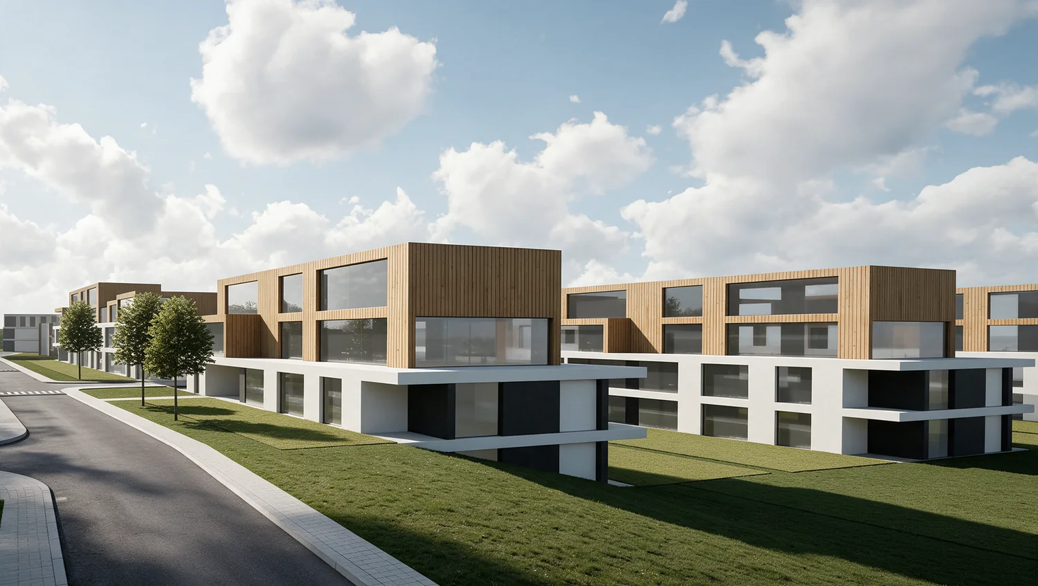
V 10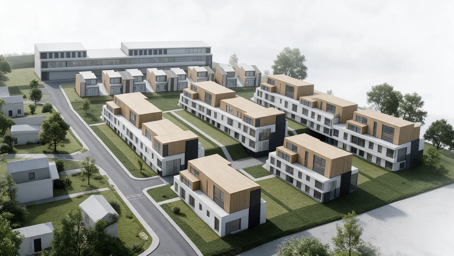
Earlier version of the study
An older version of the scheme with a higher share of apartment buildings and no semi-detached villas. The approved study corresponds to sheets V 01–V 10; this version is included for completeness.
V 11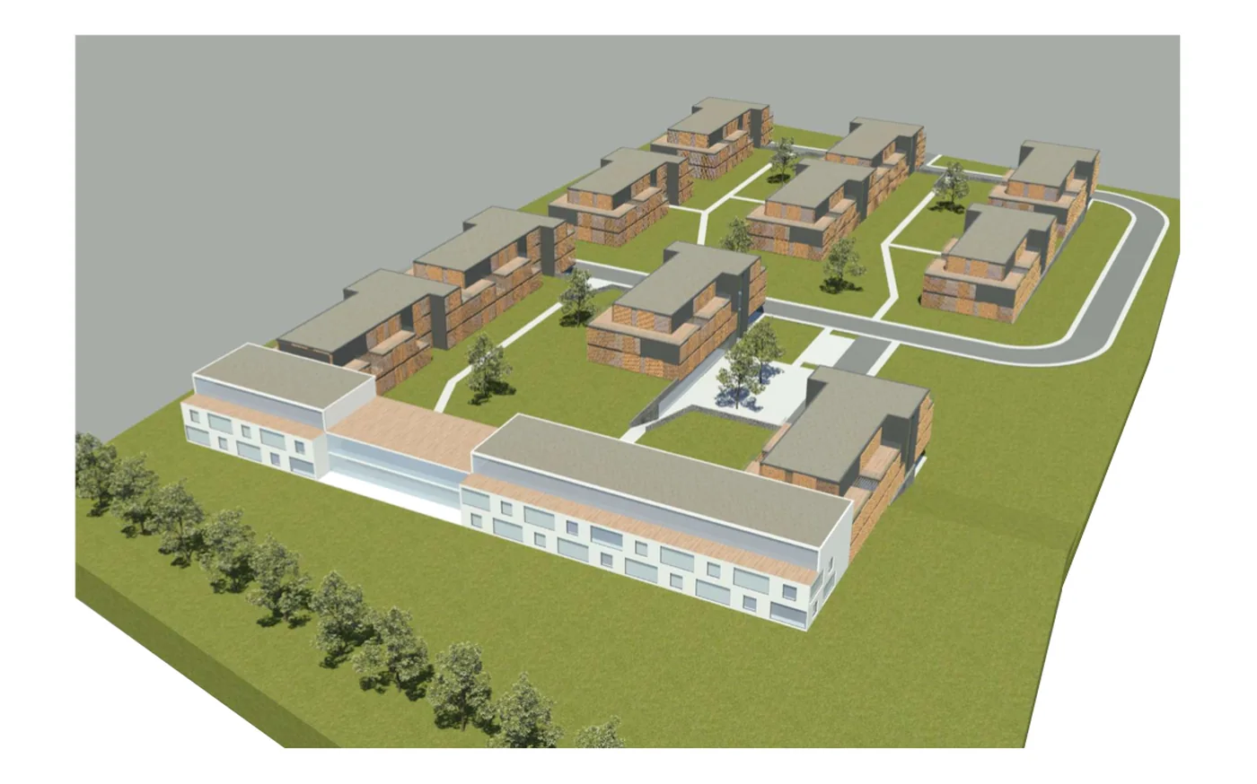
V 12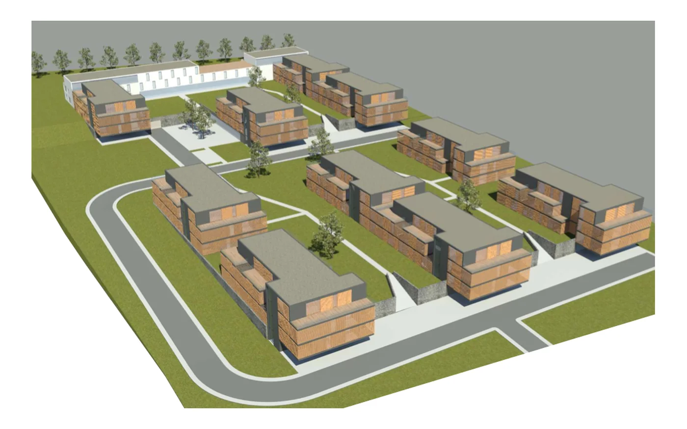
V 13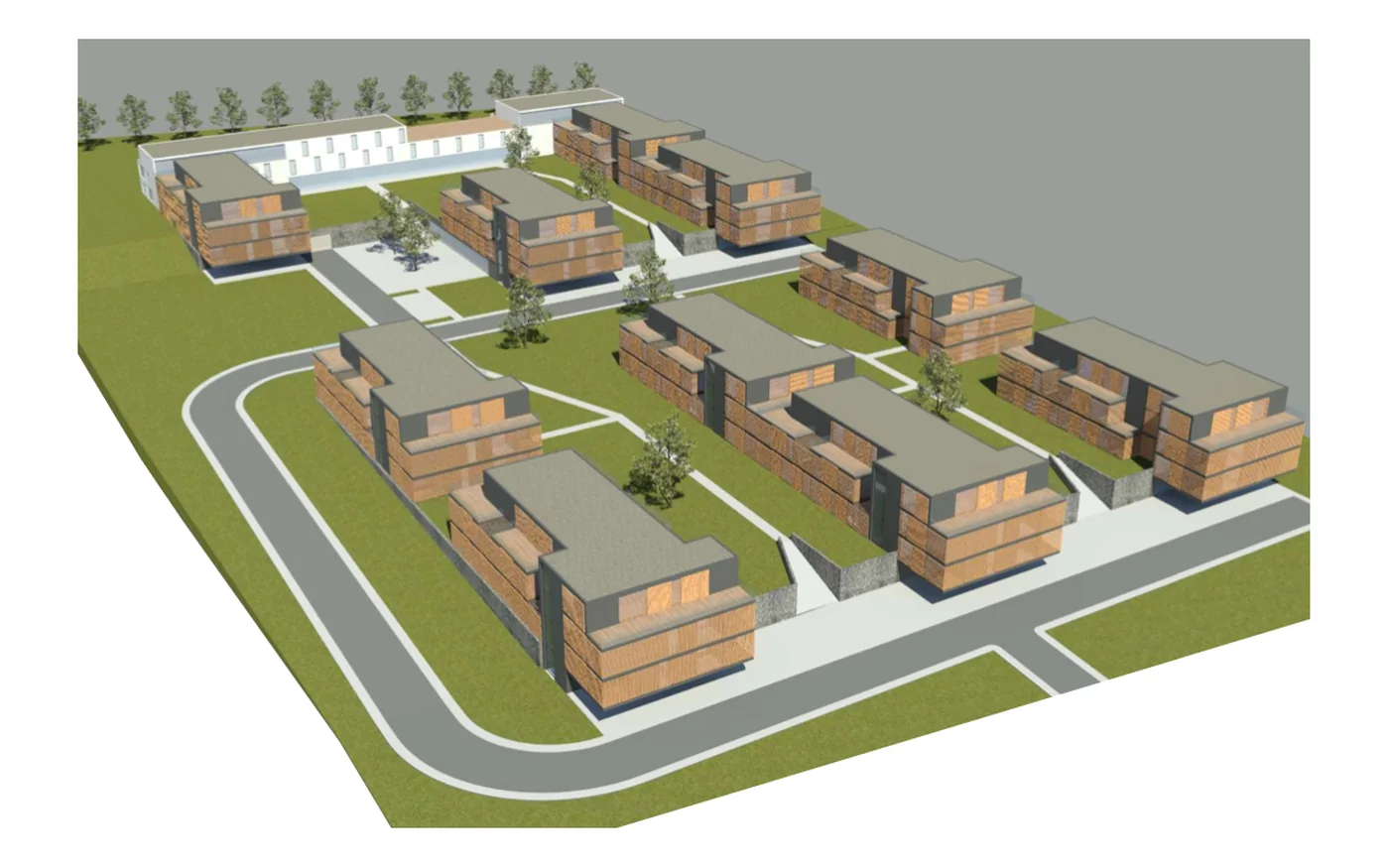
V 14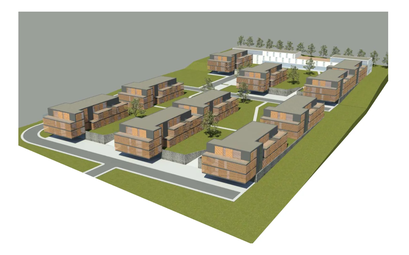
V 15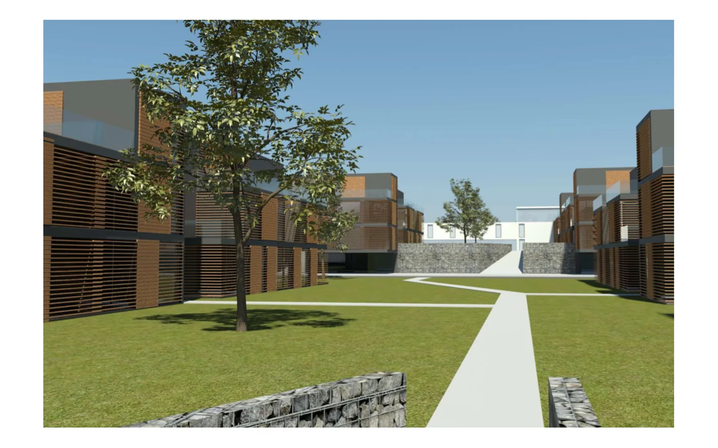
04Zoning regulations
The zoning plan
and what it allows
The plots lie within a developable area defined by the applicable zoning plan of the town of Benátky nad Jizerou.
- Land use
- Mixed-use urban residential areas SM, SM1
- Developable area
- Z16 — sites 16b, 16c
- Site coverage coefficient
- 0.60
- Permitted use
- Housing in family houses and apartment buildings, infrastructure, community facilities
Drawing 05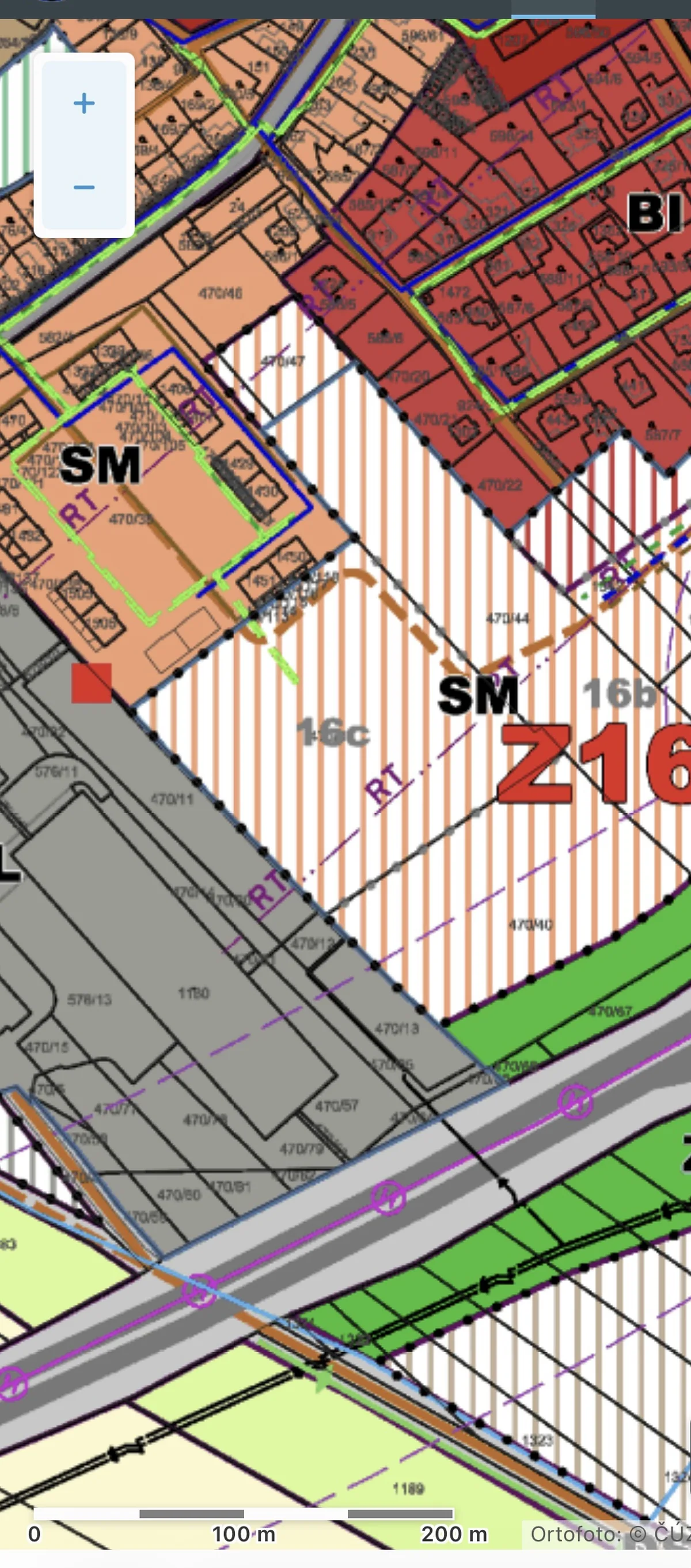
What the regulations allow
A mixed-use urban residential area permits housing in both family houses and apartment buildings, the necessary infrastructure and community facilities. The approved study demonstrates that the area can be developed to this extent.
The full text and graphic parts of the zoning documentation are included in the documents provided after the confidentiality undertaking has been signed.
05Planning status
Where the project stands today
The land is sold without a building permit. However, the project is considerably further advanced than bare land, and the seller is prepared to take part in the next steps.
Completed
Zoning study approved by the town
Prepared on the town's instructions, approved and entered in the register of spatial planning activities. It demonstrates that the area can be developed to the extent of the scheme.
StudyDesign documentation for the buildings
Apartment buildings, semi-detached villas and the mixed-use building, at the level required for a zoning decision.
DÚR stageDocumentation for utilities and roads
Utilities and roads at the level required for both a zoning decision and a building permit. Will need updating before submission.
DÚR + DSP stagesEngineering-geological survey
Prepared using a comparative method based on surveys of neighbouring buildings. The buyer may commission its own verification survey directly on the site. Included in the full documents.
SurveyAcoustic study and expert report
Measurement and assessment of noise from the D10 motorway. Included in the full documents.
Study + reportOutstanding
Updating the design documentation
Bringing the documentation into line with current regulations and the statements of the authorities concerned. The seller has declared its willingness to take part.
Step 1Consent to removal from the agricultural land fund (ZPF)
The plots are currently arable land, indicatively protection class IV. For a developable area under the applicable zoning plan, this is a standard part of the permitting process; the levy is calculated only from the area actually removed.
Step 2Zoning decision
Siting of the buildings according to the updated documentation.
Step 3Building permit
After the zoning decision is issued; the utilities documentation is already at building permit level.
Step 4
Seller's involvement
The seller has declared its willingness to take part in updating the design documentation and in further negotiations until the project is ready for construction, including the necessary consultations, statements and permits. The specific scope is subject to negotiation.
06Design documentation
Samples from the drawings
A selection from the documentation prepared for the individual buildings. The full documentation is available after the confidentiality undertaking has been signed.
PD 01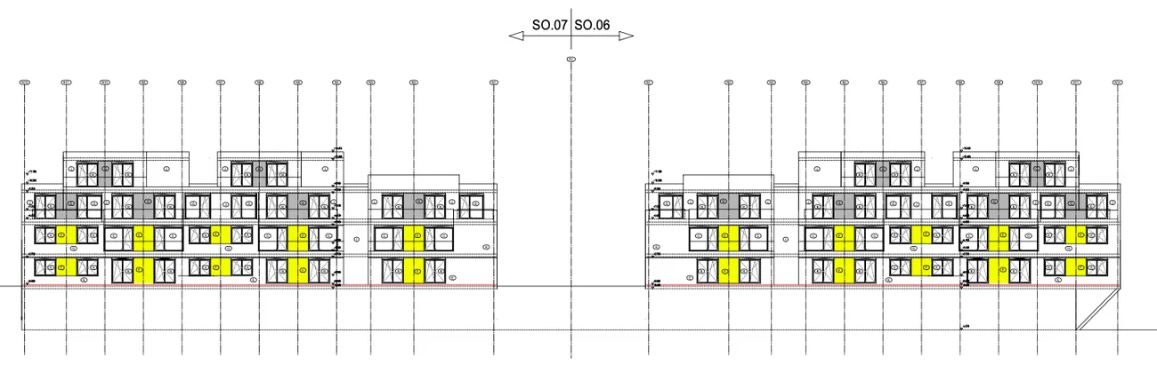
PD 02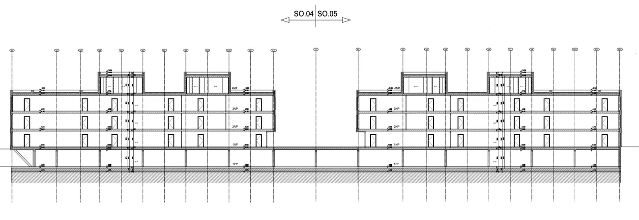
PD 03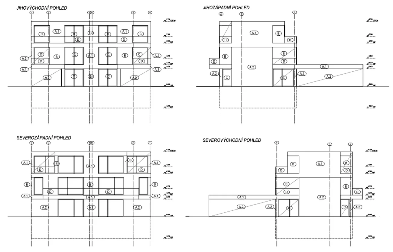
PD 04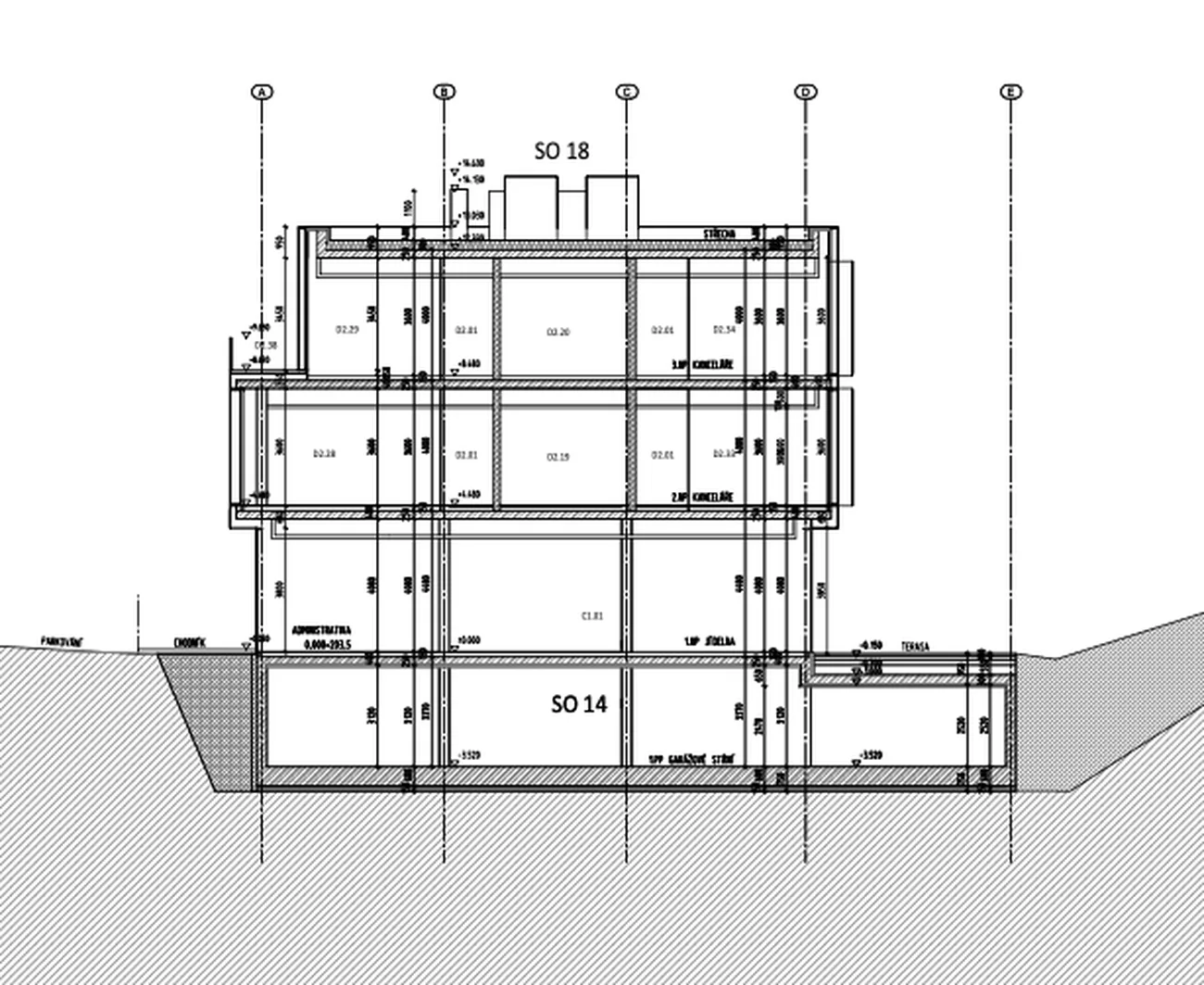
PD 05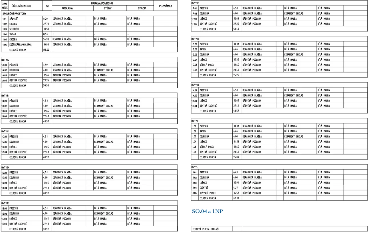
07Location
Right at the
motorway exit
The site lies between Pražská street and the D10 motorway, at exit 27. Prague is reached via the motorway without driving through any villages.
Drawing 06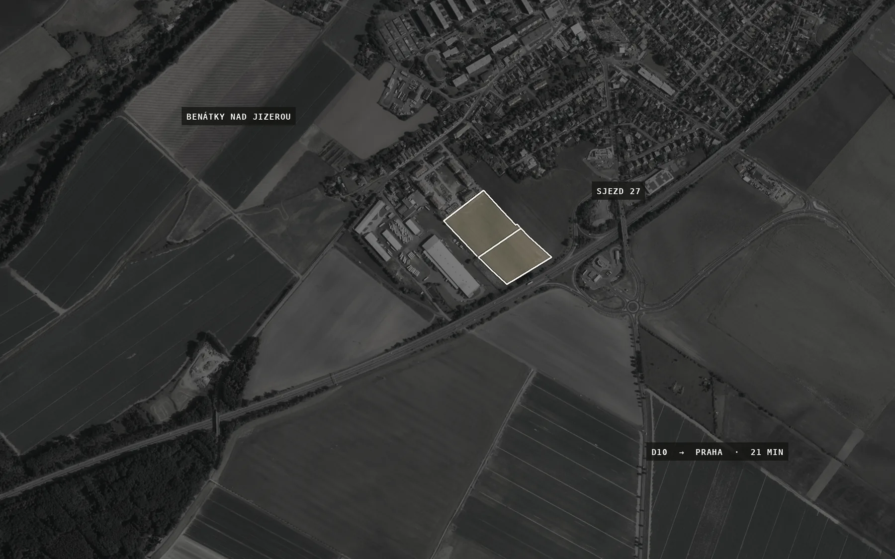
Drawing 06 Wider context · ČÚZK orthophoto
- Prague — Černý Most
- 21min by car via the D10
- Prague city centre
- 30–40min by car via the D10
- D10 exit
- 27 right next to the site
- Mladá Boleslav
- 15min by car
08Video
The offer in
the broker's words
A two-minute summary directly from the broker: the extent of the land, its permitted use, the status of project preparation and the purchase options.
What the video covers
- 01The extent of the land and its position at the D10 exit
- 02Permitted use under the zoning plan and the investor's latitude
- 03Status of the zoning study and the design documentation
- 04The seller's willingness to take part in the next steps
- 05One-off purchase versus phased purchase
If you prefer written information, all the details from the video are set out on this page.
Why Benátky nad Jizerou
What makes the location attractive
01
Access to Prague
Direct D10 exit next to the site. Prague is reached without driving through villages; Černý Most is 21 minutes away.
02
A growing town
Continuous population growth, particularly among young, economically active people.
03
Local industry
The development of local employment reduces the town's dependence on commuting to Prague.
04
Quality of life
A location on the edge between town and countryside, within reach of the Jizera river and the surrounding landscape.
05
Amenities for families
Schools, nurseries, healthcare and shops within walking distance.
06
Developer interest
Completed and ongoing residential projects in the area confirm the demand for housing.
09Documents
What is available
The basic documents can be downloaded freely. The full documentation is provided once a letter of intent with a confidentiality undertaking has been completed.
Template letter of intent (LOI)to complete and return; in Czech
Download
Zoning study — introductory partpreview; in Czech
Download
Offer summary2 pages, for forwarding; in Czech
Download
Full zoning studytext and drawings
After signingDesign documentationbuildings, utilities, roads
After signingLand registry extractLV 3384
After signingAcoustic study and expert reportmeasurement and assessment
After signingEngineering-geological surveycomparative method, in Czech
After signingFull-resolution site plansincluding utilities
After signing10Full documents
Request
documentation
Please enter the details of the requesting company and confirm the confidentiality undertaking. We pass the request on to Jan Holický, who will send you the first level of documents, usually within a working day. The full documentation is made available once the letter of intent (LOI) has been signed.
Prefer not to fill in the form? Call — +420 733 423 333
11Frequently asked questions
What investors ask
Is the land intended for residential development?
Yes. Under the applicable zoning documentation, the plots have long been part of a developable area. A zoning study was also prepared for the locality and adopted by the town. Project documentation for the residential complex is available, comprising apartment buildings, semi-detached houses and an office and commercial part.
Does the project have a final building permit?
A final building permit is not available at present. The project documentation was discussed with the authorities in the past and will need to be updated to reflect the current requirements of the building authority and the new Building Act. The seller is prepared to help with updating the documentation, obtaining the necessary statements and preparing documents for the application. Alternatively, the buyer may take over these steps in exchange for an appropriate discount on the purchase price.
Are utilities available in the locality?
Yes. According to the available documents, both the sewerage and the water supply network have sufficient capacity for the proposed project. Two water connections and approximately 100 metres of new water main are planned. Project documentation for the utilities has been prepared, and further steps to complete it may form part of the agreement with the buyer.
Are additional infrastructure investments or a contribution from the town required?
According to the available information, no contribution was required towards the construction of a wastewater treatment plant or the utility networks. The costs of completing the necessary negotiations and documentation can be settled within the purchase price or as a discount if the buyer takes over these tasks.
How is noise from the motorway dealt with?
An acoustic study was prepared for the locality. The project combines an office building, terrain modelling and an earth embankment, which can be created from soil excavated for the underground garages. According to the conclusions of the study, this solution should significantly reduce noise for approximately 95 % of the apartments. Noise-protection windows are planned for the remaining apartments.
What surveys and documents are available for the project?
An engineering-geological survey was carried out using a comparative method based on data from surveys of neighbouring buildings. An acoustic study and the related project documentation are also available. The buyer may carry out its own verification geological or hydrogeological survey directly on the site in line with its requirements and financing standards.
What might the costs of removing the land from the agricultural land fund be?
The plots lie in a developable area under the zoning plan. As an indication, protection class IV of the agricultural land fund (ZPF) and a rate of approximately CZK 19.24 per square metre actually removed can be assumed for the locality. The levy will not automatically be calculated from the total area of the plots, but only from the area actually removed from the ZPF. The exact amount will be set by the competent authority according to the specific project and the applicable soil-ecological unit (BPEJ).
Can the purchase price or the transfer be split into phases?
Yes. By agreement, the transaction can be structured in phases, for example in two or three payment stages. Individual parts of the land may also be transferred gradually in line with the part of the purchase price already paid, or deferred payments may be secured by other legal means. The agreement may also include an option in which the buyer takes over the completion of the permitting and design processes in exchange for an appropriate discount on the purchase price.
What exactly will I receive after signing the letter of intent?
The full zoning study (text and drawings), design documentation for the buildings, utilities and roads, a land registry extract, the acoustic study and expert report, the engineering-geological survey and full-resolution site plans.
How is access to the site secured?
Access is secured by an easement of passage, vehicular access and entry, registered on the title deed. Details, including the geometric plans, are part of the full documents.
12Contact
Broker for
the offer
I also answer questions by telephone, without the form. If you need documents to present to an investment committee or a bank, I will prepare them in the required format.

Jan Holický
Certified private broker
Brokers the sale of the land on behalf of the owner. Answers questions personally, by telephone and by email.
- Telephone
- +420 733 423 333
- [email protected]
- Website
- janholicky.cz
- Office
- Vršovická 160/1, Prague 10 — Vršovice
- Company ID
- 87713161